(WJZY) — More tornado days could be coming to the Carolinas, and there are a few reasons for that.
“I’m a giant weather geek, I love the weather, I love telling people about the weather, communicating weather information,” said Dr. Victor Gensini, a meteorology expert and he’s top in the country when it comes to figuring out how climate change impacts tornadoes, “there’s so much we don’t know so as a researcher it’s really fascinating and really fun.”
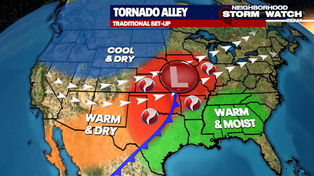
The Great Plains of Texas, Oklahoma, and Kansas have traditionally been known as “tornado alley.” This is where we often get the clashes of warm, moist air and cool, dry air to spawn tornadoes, especially in spring.
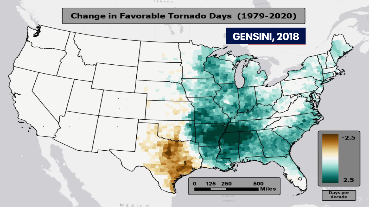
“And what we’ve actually seen over the last 40 years is the number of tornadoes happening there is going down,” explains Dr. Gensini, lead researcher on the study at Northern Illinois University.
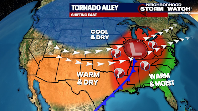
This is the change Dr. Gensini observed: it shows a decrease in tornadoes in the brown color in the Plains, an increase east in that green color…including the Carolinas. The core of tornado alley is shifting east into the Mid-South and Southeast. But why?
“We’ve really only been able to step on the scale and see that we lost a bunch of weight, we’re just not sure if it’s because our diet is good or our exercise is good, we’re not 100% sure what’s causing it at the moment,” explains Dr. Gensini.
What we do know: Climate change is making droughts in the southwest worse, expanding the dry air and expanding deserts to the east. As the traditional tornado alley loses moisture — the key ingredient for tornadoes — areas east are seeing a muggy surge.
Dr. Gensini elaborates, “We have all this dry air, the movement, the expansion of that air, but we also have a more favorable air mass especially early on in the year. Think March, think April. Basically, spring coming sooner, our severe weather season starts a little bit earlier.
In a trend since 1970, we have nine more warm spring days in Charlotte. That’s more fuel for tornadoes.
And in the fall, warm Gulf waters help boost the muggies too. “The warmer that water is, there’s a pretty good signal when you have warmer water like that you’ll have an above average tornado season especially during the cool season,” notes Dr. Gensini.
An extra month of the severe weather season could put a dent in your pocket, “We start to see regional responses in things like insurance policy premium, and the need for disaster mitigation from FEMA,” explains Dr. Gensini.


