‘Potentially historic’ storm could drop up to 6 feet of snow in Colorado
DENVER (KDVR) — A major weekend snowstorm is on track to drop up to 6 feet of snow in some parts of Colorado. The storm is part of a system that is expected to pummel parts of the Rockies and High Plains with snow that could hinder travel, damage trees and knock out power in parts of Colorado, Wyoming and western Nebraska, according to The Weather Channel.
In Colorado, a cold front arrives Friday with snow showers on and off in Denver and 1 to 2 inches into the Foothills.
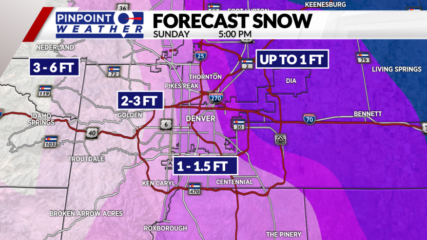
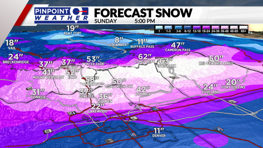
The window for the heaviest snow is Saturday afternoon into Sunday morning, with it tapering off Sunday night and early Monday. Totals of 1 to 2 feet of snow are forecast for Denver, with 2 to 6 feet expected in the Foothills.
The National Weather Service in Cheyenne, Wyoming, described the storm as a “potentially historic event taking shape” with “blizzard conditions possible.” Several inches of snow could fall per hour at times Saturday and Sunday, The Weather Channel reported, with East to northeast winds intensifying Saturday into Sunday, possibly leading to blizzard conditions in open country.
In Denver, the National Weather Service tweeted Wednesday that the storm had a “low to medium potential to approach the March 2003 historical snowstorm.” That storm covered Denver with 31.8 inches of snow, its second-heaviest snowfall dating to 1881, according to the NWS.
The mix of wet, heavy snow and strong winds may damage trees and trigger power outages and cause some roadways to become impassable, according to The Weather Channel.


