La Niña isn’t going away. Here’s how long NOAA says it could last

La Nina, which often means a busier Atlantic hurricane season, a drier Southwest and perhaps a more fire-prone California, may persist well into 2022, the National Oceanic and Atmospheric Administration announced Thursday. (NOAA via AP)
(NEXSTAR) – A La Niña winter may turn into a La Niña spring, the National Oceanic and Atmospheric Administration’s Climate Prediction Center said Thursday.
La Niña conditions, which emerged in October, have a 90% chance of persisting through the winter months, and a 50% chance of continuing through spring.
“The forecaster consensus anticipates La Niña to persist longer, potentially returning to ENSO-neutral during April-June 2022,” NOAA said in its outlook. (ENSO-neutral describes a climate pattern that is neither El Niño nor La Niña.)
Why does it matter if it’s a La Niña year or not? It affects the type of weather we see across the United States.

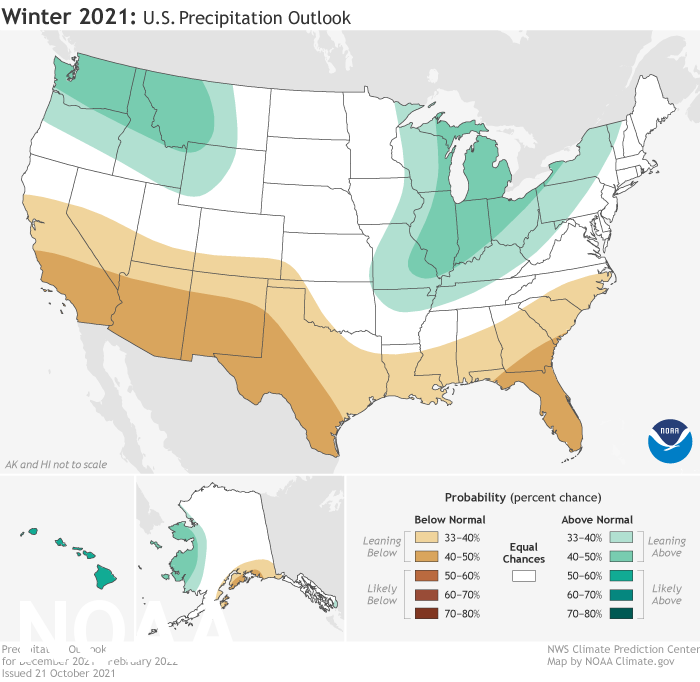
La Niña typically brings drier conditions to the southern half of the country and more rain and snow to pockets of the northern half. This year, NOAA meteorologists are forecasting a wetter winter for Michigan, Wisconsin, Illinois, Indiana, Missouri, Ohio, western New York and western Pennsylvania.
Conditions are also favoring a wet winter in the Pacific Northwest, which has been plagued by drought. However, things look particularly bad for the drought in the Southwest, where dry conditions are forecast to worsen over the next few months.
California is split in two by a La Niña pattern, bringing more rain to Northern California and below-normal precipitation to Southern California — though it’s hard to predict exactly where that line will fall. The past several weeks have already brought more rain to Northern California than the southern half of the state.
When it comes to temperature, this winter is forecast to be warmer than average for most of the country, especially the Gulf states.
This year, a moderate-strength La Niña is expected, said NOAA meteorologists Thursday.


