Antarctica hit 70 degrees above average in March, an apparent world record

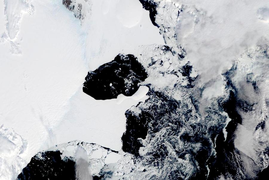
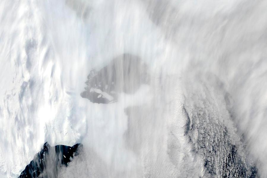
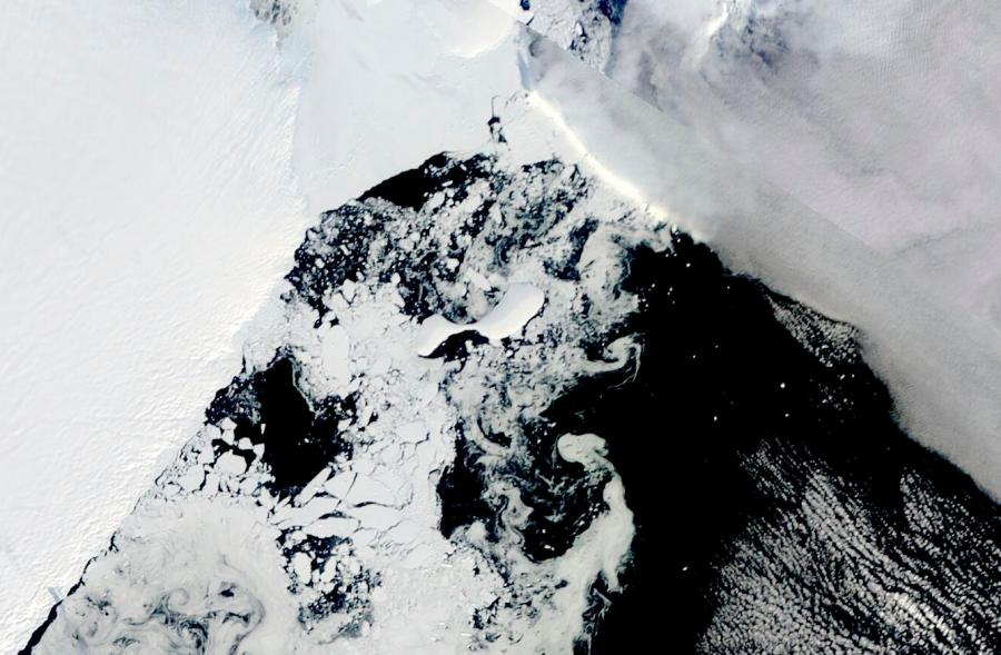
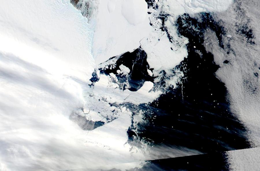
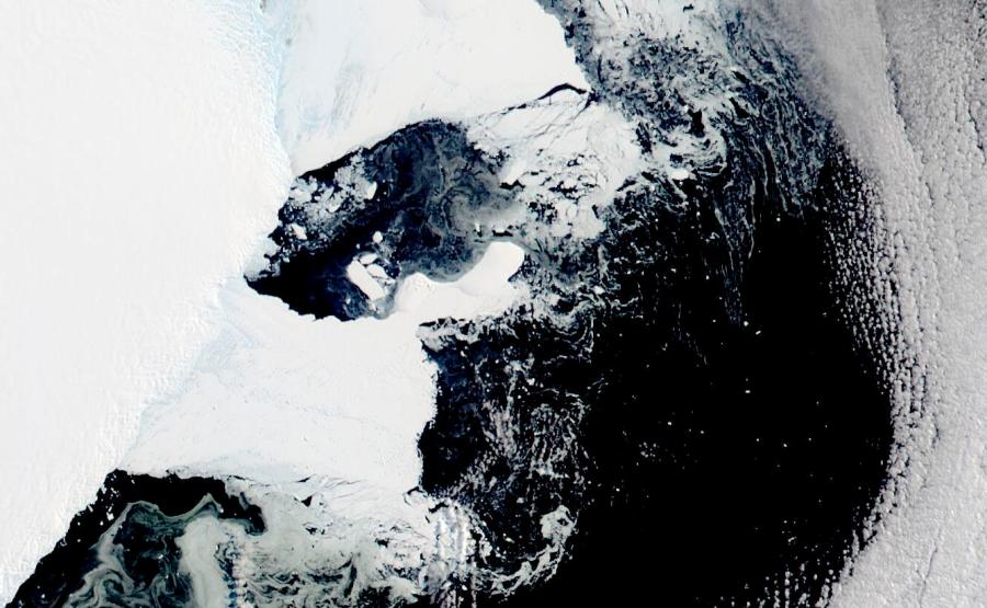
This satellite image provided by NASA, Aqua MODIS 21 on March 2022 shows the two pieces of C-38 (A and B icebergs) next to the main piece of C-37 at the top. Scientists are concerned because an ice shelf the size of New York City collapsed in East Antarctica, an area that had long been thought to be stable. The collapse last week was the first time scientists have ever seen an ice shelf collapse in this cold area of Antarctica.(Dr. Christopher A. Shuman, UMBC/NASA via AP)
(NEXSTAR) – Ten days ago weather stations in Antarctica recorded a mind-bending heatwave that saw temperatures rip 70 degrees above the normal temperature for that time of year – an increase scientists say was likely a new record.
“The recent extraordinary heatwave in Antarctica appears to have set a new World Record for the largest temperature excess above normal (+38.5 °C / +69.3 °F) ever measured at an established weather station,” Dr. Robert Rhode, the lead scientist with Berkeley Earth, tweeted Monday.
Between March 15 and 18, both of Earth’s poles experienced extreme heat for that time of year in a rare occurrence that also saw areas of the Arctic more than 50 degrees (30 degrees Celsius) warmer than average.
At the beginning of the warm spell, an ice shelf the size of New York City collapsed in East Antarctica. The collapse, captured by satellite images, marked the first time in human history that the frigid region had an ice shelf collapse.
In Antarctica, the two-mile high (3,234 meters) Concordia station was at 10 degrees (-12.2 degrees Celsius) on March 18, which is about 70 degrees warmer than average, while the even higher Vostok station hit a shade above 0 degrees (-17.7 degrees Celsius), beating its all-time record by about 27 degrees (15 degrees Celsius), according to a tweet from extreme weather record tracker Maximiliano Herrera. The coastal Terra Nova Base was far above freezing at 44.6 degrees (7 degrees Celsius).
For some perspective, the wild 70-degree temperature change would be akin to Cleveland going from its March average high of 45 degrees one day to a blistering 115 the next.
Professor Randall Cerveny, who teaches geographical sciences at Arizona State University and also serves as the Rapporteur on Extreme Records for the United Nations/World Meteorological Organization (WMO), told CNN that the WMO doesn’t track temperature-above-average records. He added that the stats he had seen appeared to support Rhode’s tweet, however.
“Everything that I personally have seen about the Dome C observation suggests that it is a legitimate observation,” Cerveny said.
The jump in temperature caught officials at the National Snow and Ice Data Center in Boulder, Colorado, by surprise because they were paying attention to the Arctic where it was 50 degrees warmer than average and areas around the North Pole were nearing or at the melting point, which is really unusual for mid-March, said center ice scientist Walt Meier.
“They are opposite seasons. You don’t see the north and the south (poles) both melting at the same time,” Meier told The Associated Press Friday evening. “It’s definitely an unusual occurrence.”
“It’s pretty stunning,” Meier added.
“Wow. I have never seen anything like this in the Antarctic,” said University of Colorado ice scientist Ted Scambos, who returned recently from an expedition to the continent.
“Not a good sign when you see that sort of thing happen,” said University of Wisconsin meteorologist Matthew Lazzara.
Lazzara monitors temperatures at East Antarctica’s Dome C-ii and logged 14 degrees (-10 degrees Celsius) Friday, where the normal is -45 degrees (-43 degrees Celsius): “That’s a temperature that you should see in January, not March. January is summer there. That’s dramatic.”
Both Lazzara and Meier said what happened in Antarctica is probably just a random weather event and not a sign of climate change. But if it happens again or repeatedly then it might be something to worry about and part of global warming, they said.
The Antarctic warm spell was first reported by The Washington Post.
The Antarctic continent as a whole on Friday was about 8.6 degrees (4.8 degrees Celsius) warmer than a baseline temperature between 1979 and 2000, according to the University of Maine’s Climate Reanalyzer, based on U.S. National Oceanic Atmospheric Administration weather models. That 8-degree heating over an already warmed-up average is unusual – think of it as if the entire United States was 8 degrees hotter than normal, Meier said.
At the same time, on Friday, March 18, the Arctic as a whole was 6 degrees (3.3 degrees) warmer than the 1979 to 2000 average.
By comparison, the world as a whole was only 1.1 degrees (0.6 degrees Celsius) above the 1979 to 2000 average. Globally, the 1979 to 2000 average is about half a degree (.3 degrees Celsius) warmer than the 20th-century average.
What makes the Antarctic warming really weird is that the southern continent — except for its vulnerable peninsula which is warming quickly and losing ice rapidly — has not been warming much, especially when compared to the rest of the globe, Meier said.
Antarctica did set a record for the lowest summer sea ice — records go back to 1979 — with it shrinking to 741,000 square miles (1.9 million square kilometers) in late February, the snow and ice data center reported.
What likely happened was “a big atmospheric river” pumped in warm and moist air from the Pacific southward, Meier said.
And in the Arctic, which has been warming two to three times faster than the rest of the globe and is considered vulnerable to climate change, warm Atlantic air was coming north off the coast of Greenland.
The Associated Press contributed to this report.


