NOAA releases spring weather predictions: What to expect where you live

Snow hangs onto the bright spring blooms on a tree in downtown Bristol, Tenn., Saturday, March 12, 2022, following the overnight storm passing through the area. (David Crigger/Bristol Herald Courier via AP)
(NEXSTAR) – Forecasters at the National Weather Service released their new three-month outlook Thursday, giving us a preview of what’s in store for spring weather nationwide.
First and foremost, La Niña is set to hold strong until the summer, the outlook confirmed. La Niña affects weather in the U.S. by typically bringing drier conditions to the southern half of the country and more precipitation to pockets of the northern half.
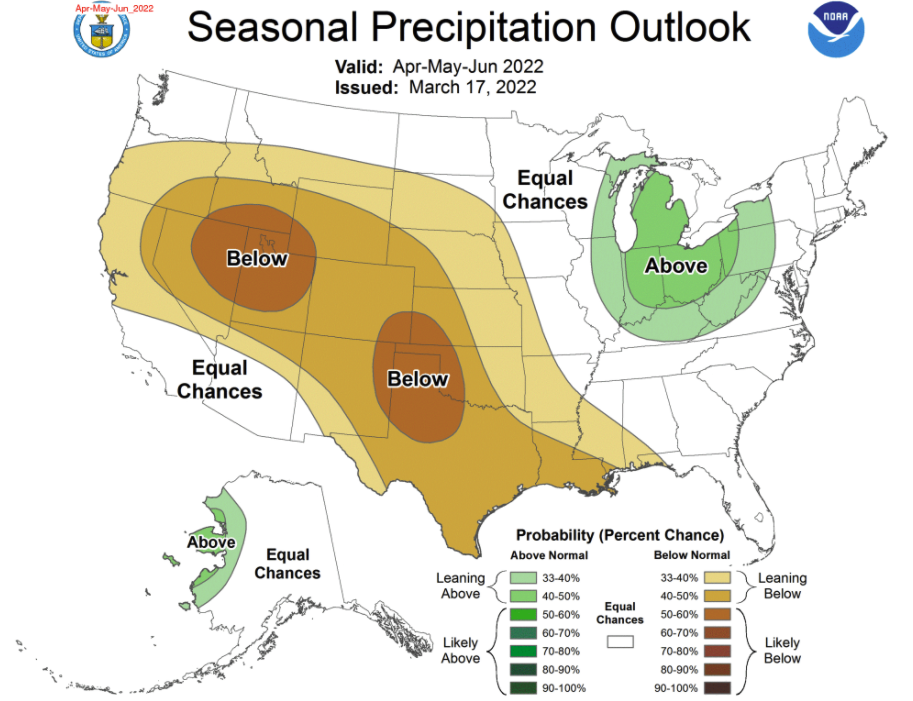
You can see the effects of La Niña on the spring weather outlook in the map below. A huge swath of the country – from Oregon and Northern California, through the Mountain West and Plains, down to Texas and the Gulf – is predicted to see drier-than-normal spring weather.
There are two bullseyes of especially dry conditions predicted by the National Oceanic and Atmospheric Administration’s Climate Prediction Center: one over the Texas panhandle and one over Utah and Nevada.

The only part of the continental U.S. expected to see above-normal precipitation the next three months is some of the Great Lakes region.
Much of the Western U.S. is already plagued by drought conditions. If NOAA’s predictions for the next three months hold true, the drought will only worsen as the region heads into its driest summer months.
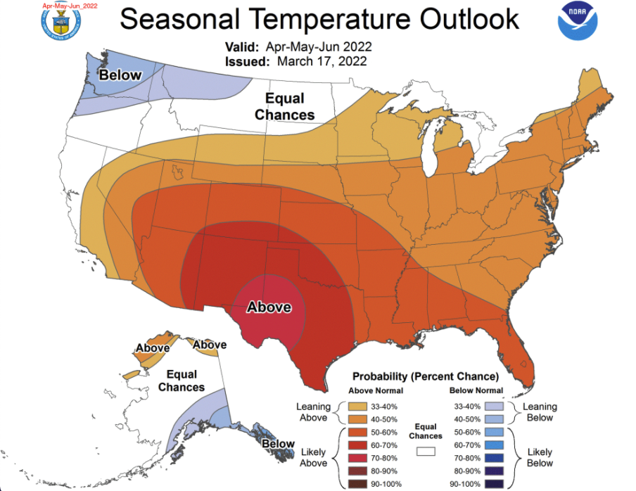
It’s not just going to be dry – in most states it’s also going to be hot, the outlook indicates. The vast majority of states can expect a hot spring, especially New Mexico, Texas and Western Oklahoma.

Only a tiny sliver of the country, in the Pacific Northwest, is forecast to see a cool spring.
The Hawaiian islands aren’t shown on the maps above, but are expected to see above-normal temperatures and above-normal precipitation over the next three months, the National Weather Service predicts.


