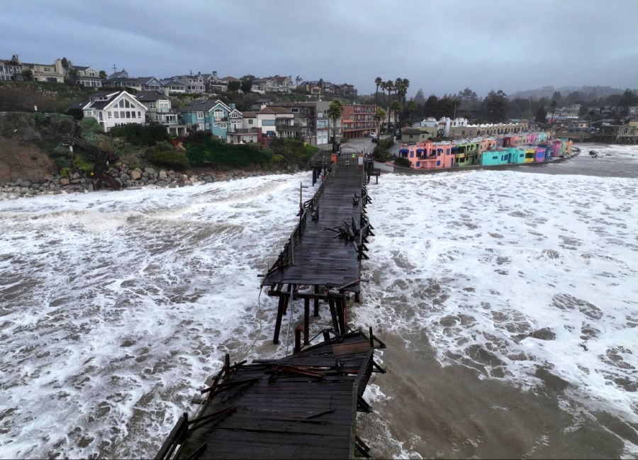
(NewsNation) — While the Eastern U.S. has enjoyed a lot of warmer weather for this time of year for January, the West is getting lashed by several storms — with more flood danger to come.
A “Pineapple Express” storm originated near Hawaii and was pulled toward the West Coast by a rotating area of rapidly falling air pressure known as a “bomb cyclone.”
In California, the wind and rain are packing a ferocious bite, causing power outages that put over 200,000 in the dark. Hurricane-force winds were measured in numerous locations. The worst of the wind was gusting over 100 miles per hour and higher, turning a number of trees into timber. Over 10 inches of rain have overwhelmed drains and filled city streets.
Waves are causing coastal flooding, as well as land and mudslides, cutting drivers off along many major roads. Californians are a bit surprised at how big of a punch Mother Nature can pack, but also appreciative for the badly-needed moisture to replenish the beyond-parched Golden State. Not including the latest deluge, recent storms moved parts of the state out of the “exceptional drought” category in the U.S. Drought Monitor. Most of the state, though, remains in the extreme or severe drought categories.
“Mother Nature, she’ll do anything. Yeah, we’ve got a lot of we need rain, but the destruction comes with it.,” one woman said. “We’re swamped.”

Another California resident said he’s been running around taking trees off houses and fences. “It’s crazy,” he said.
And there’s still much more to come. NewsNation’s Gerard Jebaily has been watching the ferocity of the storm systems as they just roll in and batter the coastline.
“We are going to be continuing to watch many more of these systems rolling in and causing more issues,” he said. “We do have, again, waves and waves of energy coming off the coastline. The next one’s going to be hitting as we get into Saturday.”
When this happens, it will likely bring more rainfall, or possibly more landslides. Another storm will move in earlier next week, Jebaily said, with another five to 10 inches of rain.
“Once we get a little bit later on into the week, we may finally get a little bit of a break, but this is going to be a long-duration event for these folks in California,” he added. “They are pretty taken aback at how powerful it’s been.”
California Gov. Gavin Newsom declared a state of emergency to allow for a quick response and to aid in the cleanup from another powerful storm that hit just days earlier.
The Associated Press contributed to this report.


