
Hurricane Ian nears Florida after leaving Cuba in the dark
maylen


(NewsNation) — Florida emergency personnel were standing at the ready Tuesday night to respond to a major hurricane that was expected to make landfall within the next 24 hours.
Hurricane Ian tore into western Cuba as a major hurricane Tuesday, knocking out power to the entire country and leaving 11 million people without electricity, before churning on a collision course with Florida over warm Gulf waters amid expectations it would strengthen into a catastrophic Category 4 storm.
Gov. Ron DeSantis and state emergency leaders spent Tuesday warning residents to evacuate and prepare for torrential rains and heavy winds. The storm was a Category 3 late Tuesday and centered less than 200 miles from the western coast, moving at about 10 mph, according to the National Hurricane Center.
Evacuation orders have been issued for people in coastal communities, mobile homes and low-lying areas in 12 counties. In some areas, police were seen driving through the neighborhood urging those still in their homes to leave and seek shelter.
Tropical storm-force winds were expected across the state’s southern peninsula late Tuesday, reaching hurricane-force Wednesday — when the eye was predicted to make landfall. With tropical storm-force winds extending 140 miles from Ian’s center, damage was expected across a wide area of Florida.
DeSantis held a media briefing at the State Emergency Operations Center in Tallahassee on Tuesday, saying the storm surges would “far eclipse” those produced by Hurricane Charley, a Category 4 hurricane that hit Florida in 2004.
“What we have here is really historic storm surge and flooding potential,” DeSantis said.
In a second news conference Tuesday, DeSantis said updated models of the hurricane now reflect the anticipated landfall of the storm over the Sarasota region, just south of Tampa.
“It’s still not set in stone,” DeSantis said. “I’d say anyone on the gulf coast (needs) to prepare for impact.”
He also said this storm is going to be different than storms in the past because forecasts have Ian slowing down when it hits land.
“Another factor that they are forecasting now, as it makes landfall … most of the forecasts have it slowing down to almost a crawl,” DeSantis explained. “What that means is that it’s going to dump an inordinate amount of rain.”
He said it is going to be a major water event in terms of the storm surge and flooding.
In a third news conference Tuesday night, DeSantis and other leaders from state emergency agencies said they stand at the ready to respond to residents’ needs and initiate recovery efforts once the storm passes.
Tolls have been suspended along interstates to allow for faster evacuations, and bridges will be closed when certain wind speeds are met, officials said.
DeSantis was expected to provide further updates early Wednesday morning.
After getting 67% stronger in less than 22 hours from Monday to Tuesday, Hurricane Ian was bearing down on Florida as a possible Category 4 hurricane that threatens to deliver a nightmare storm-surge to Tampa Bay.
Students have already been evacuated from the University of Tampa, and the residents of the Florida Keys were moving their cars to higher ground as they brace for possible floods, according to the Monroe County Emergency Management.
Walt Disney World will close all theme parks and water parks on Wednesday and Thursday, as well as some resorts. Universal Orlando Resort also announced it would close on Wednesday and Thursday.
White House press secretary Karine Jean-Pierre said Tuesday night President Joe Biden and DeSantis discussed ways the federal government is helping Florida prepare for the hurricane and later committed to continue providing a closely coordinated storm response.
As of Tuesday night, at least 5,000 Florida Guardsmen have been activated and pre-positioned at armories across the state.
Before heading for Florida, Ian made landfall at 4:30 a.m. Eastern time Tuesday in Cuba’s Pinar del Rio province, where officials set up 55 shelters, evacuated 50,000 people, rushed in emergency personnel and took steps to protect crops in Cuba’s main tobacco-growing region. The storm knocked out power to the entire country, leaving 11 million people without electricity.
The National Hurricane Center said “significant wind and storm surge impacts” were occurring Tuesday morning in western Cuba. Ian’s sustained top winds were 125 mph and as much as 14 feet of storm surge was predicted along Cuba’s coast.
A Hurricane Warning has been issued for parts of west central Florida including the following counties: Pinellas, Hillsborough, Manatee, Sarasota, Polk, Lake, Seminole, Orange, Osceola, Okeechobee, Hardee, Highlands, Desoto, Charlotte, Lee and Coastal Collier. Glades, Hendry and Inland Collier are under a Hurricane Watch.
The area where the storm comes ashore could see 12 to 16 inches of rain, with some areas seeing isolated amounts of up to 24 inches. The heavy rainfall could lead to considerable flash and urban flooding and prolonged river flooding. A few tornadoes will be possible across parts of Florida on Tuesday and Wednesday, the NHC said.
It’s been more than a century since a major storm like Hurricane Ian has struck the Tampa Bay area. Many residents live in low-lying neighborhoods that are highly susceptible to storm surges and flooding.
Tampa and St. Petersburg could get their first direct hit by a major hurricane since 1921.
Tampa Bay is also under a storm surge warning, meaning the storm could raise water levels above normal tides.
The storm is forcing people to evacuate, but also reducing some of their options. The Tampa Airport announced it would cease operations at 5 a.m. Tuesday to prepare the facility for the brutal storm. A statement from the airport did not include a potential reopening time — only a promise that damage assessments would begin as soon as it was safe.
So far, 26 school districts have been closed, and more are expected to close as the storm approaches.
DeSantis said that high-water vehicles, shallow boats and search and rescue aircraft are ready for deployment. The Coast Guard is also standing by.
The threat has also forced the Tampa Bay Buccaneers to pack up and head toward Miami to practice with the Dolphins. The Buccaneers Sunday night game at home against the Kansas City Chiefs was still scheduled as of Tuesday night, though the NFL is reviewing the possibility of moving the game to another stadium.
DeSantis declared a state of emergency for the entire state of Florida on Saturday, freeing up resources for all residents. He also urged residents to be ready for a storm that could lash large swaths of the state with heavy rains, high winds and rising seas.
Tampa Mayor Jane Castor was also preparing her city for the impact of the storm.
“No doubt we’re going to feel the effects. Just how severe the effects are remain to be seen. So what we are asking is everyone to be prepared,” Castor said.
On Monday, Hillsborough County activated 40 shelters for residents, one of them a local elementary school.
“Please treat this storm seriously. It’s the real deal. This is not a drill,” Hillsborough County Emergency Management Director Timothy Dudley said at a Monday news conference on storm preparations in Tampa.
Residents waited upward of four hours to fill sandbags at one of three locations. Grocery store lines reached down the streets as many prepared for the storm.
Biden also declared an emergency, authorizing the Department of Homeland Security and the Federal Emergency Management Agency, or FEMA, to coordinate disaster relief and provide assistance to protect lives and property.
The president postponed a scheduled Sept. 27 trip to Florida due to the storm and NASA decided to forgo a planned Tuesday launch opportunity for its new moon rocket.
The agency advised Floridians to have hurricane plans in place and monitor updates of the storm’s evolving path.
Georgia Gov. Brian Kemp on Sunday ordered the activation of the State Operations Center for Monday, to prepare for any potential impact from Hurricane Ian later in the week.
NewsNation affiliate WFLA and the Associated Press contributed to this report.
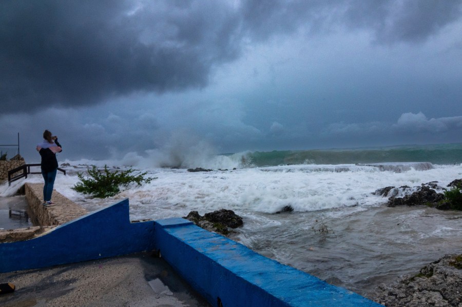
A woman takes photos while waves crash against a seawall as Hurricane Ian passes through George Town, Grand Cayman island, Monday, Sept. 26, 2022. Hurricane Ian is on a track to hit the west coast of Florida as a major hurricane as early as Wednesday. (AP Photo/Kevin Morales) 
ST. PETERSBURG, FLORIDA – SEPTEMBER 26: Chris Tate (L) and Heather Tallmadge and other people fill sandbags at Helen Howarth Park as they prepare for the possible arrival of Hurricane Ian on September 26, 2022 in St Petersburg, Florida. Ian is projected to make it’s closest pass to the Tampa Bay area on Wednesday with the current track putting the center 25 miles west of the coastline as it parallels the coast. (Photo by Joe Raedle/Getty Images) 
ST. PETERSBURG, FLORIDA – SEPTEMBER 26: Eglantine Leguerchois boards up the Paradise Sweets store in preparation for Hurricane Ian on September 26, 2022 in St. Petersburg, Florida. Ian is projected to make its closest pass to the Tampa Bay area tomorrow, with current tracking putting the center 25 miles west of the coastline and northern bound along the Atlantic seaboard. (Photo by Joe Raedle/Getty Images) 
ST. PETERSBURG, FLORIDA – SEPTEMBER 26: Luca Leguerchois (L) and Eglantine Leguerchois board up their Paradise Sweets store in preparation for Hurricane Ian on September 26, 2022 in St. Petersburg, Florida. Ian is projected to make its closest pass to the Tampa Bay area tomorrow, with current tracking putting the center 25 miles west of the coastline and northern bound along the Atlantic seaboard. (Photo by Joe Raedle/Getty Images) 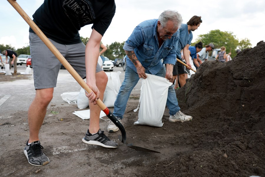
ST. PETERSBURG, FLORIDA – SEPTEMBER 26: John Gallo and other people fill sandbags at Helen Howarth Park as they prepare for the possible arrival of Hurricane Ian on September 26, 2022 in St Petersburg, Florida. Ian is projected to make it’s closest pass to the Tampa Bay area on Wednesday with the current track putting the center 25 miles west of the coastline as it parallels the coast. (Photo by Joe Raedle/Getty Images) 
Johnny Ford, right, and his wife Jerria Ford fill free sand bags at an Orange County park in preparation for the arrival of Hurricane Ian, Monday, Sept. 26, 2022, in Orlando, Fla. (AP Photo/Phelan M. Ebenhack) 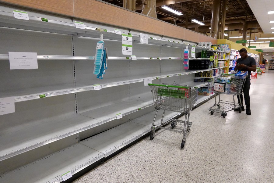
ST. PETERSBURG, FLORIDA – SEPTEMBER 26: A person stands in an empty water aisle in a grocery store as people stock up on necessary items in prepartation for the possible arrival of Hurricane Ian on September 26, 2022 in St Petersburg, Florida. Stores were re-stocking with water for customers before the storm’s arrival. Ian is projected to make its closest pass to the Tampa Bay area on Wednesday with the current track putting the center 25 miles west of the coastline as it parallels the coast. (Photo by Joe Raedle/Getty Images) 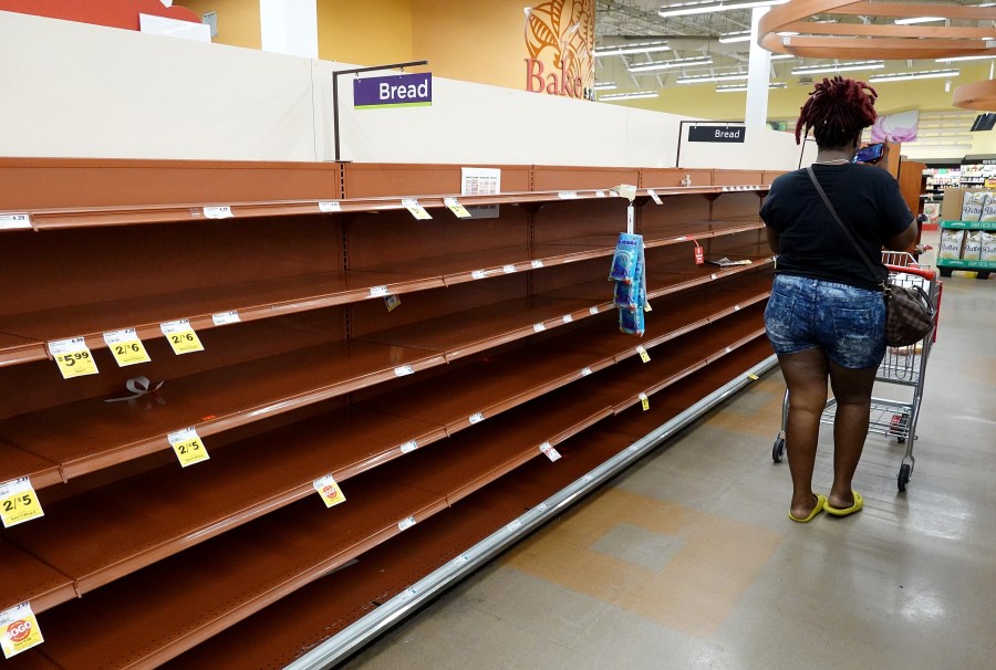
ST. PETERSBURG, FLORIDA – SEPTEMBER 26: Shelves in the bread aisle stand empty as residents prepare for Hurricane Ian on September 26, 2022 in St Petersburg, Florida. Ian is projected to make its closest pass to the Tampa Bay area tomorrow, with current tracking putting the center 25 miles west of the coastline and northern bound along the Atlantic seaboard. (Photo by Joe Raedle/Getty Images) 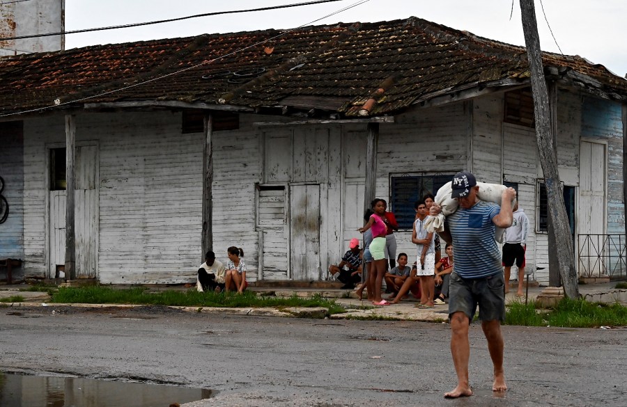
A man carries a sack with food in Batabano, Mayabeque province, on September 26, 2022, ahead of the arrival of Hurricane Ian. – Cuba declared an emergency alert in its six most western provinces as fast-approaching Hurricane Ian was moving northwest towards Cuba and the Cayman Islands with maximum sustained winds of 85 miles (135 kilometres) per hour. (Photo by ADALBERTO ROQUE / AFP) (Photo by ADALBERTO ROQUE/AFP via Getty Images) 
A family carries a dog to a safe place in Batabano, Mayabeque province, on September 26, 2022, ahead of the arrival of Hurricane Ian. – Cuba declared an emergency alert in its six most western provinces as fast-approaching Hurricane Ian was moving northwest towards Cuba and the Cayman Islands with maximum sustained winds of 85 miles (135 kilometres) per hour. (Photo by ADALBERTO ROQUE / AFP) (Photo by ADALBERTO ROQUE/AFP via Getty Images) 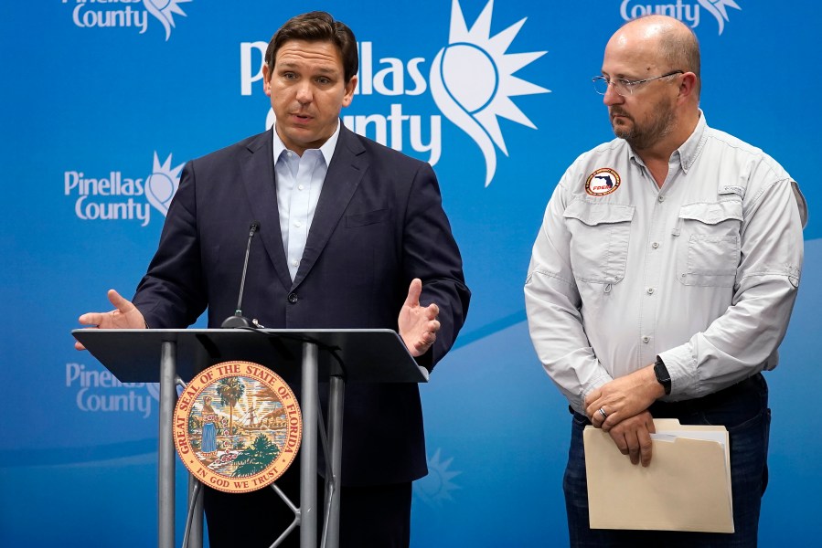
Florida Gov. Ron DeSantis, left, speaks as he stands with Kevin Guthrie, director of the Florida Division of Emergency Management, during a news conference, Monday, Sept. 26, 2022, in Largo, Fla. DeSantis was keeping residents updated on the track of Hurricane Ian. (AP Photo/Chris O’Meara) 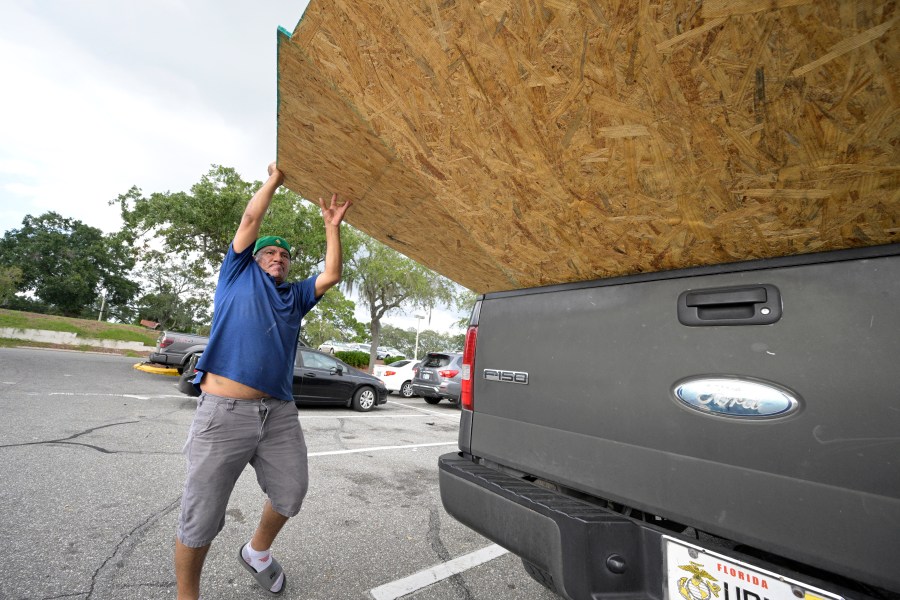
Jesus Rodrigues loads wood in his vehicle outside a Home Depot store in preparation for the arrival of Hurricane Ian, Monday, Sept. 26, 2022, in Orlando, Fla. Ian was growing stronger as it approached the western tip of Cuba on a track to hit the west coast of Florida as a major hurricane as early as Wednesday. (AP Photo/Phelan M. Ebenhack) 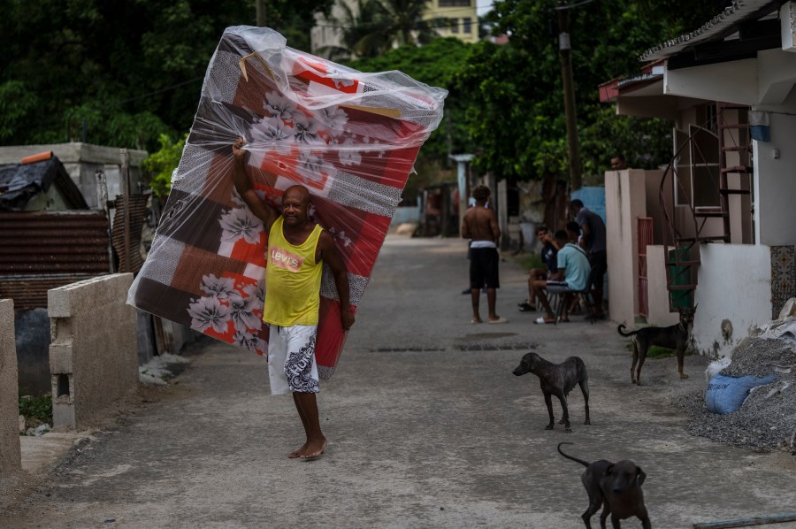
A resident of El Fanguito neighborhood carries a mattress in preparation for the arrival of Hurricane Ian, in Havana, Cuba, Monday, Sept. 26, 2022. Hurricane Ian is growing stronger as it approached the western tip of Cuba on a track to hit the west coast of Florida as a major hurricane as early as Wednesday. (AP Photo/Ramon Espinosa) 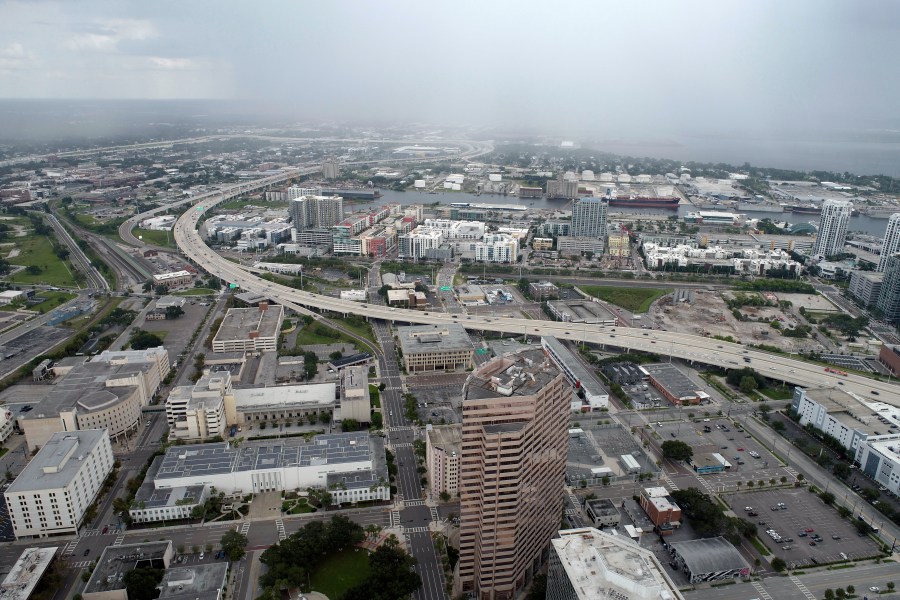
In this aerial image, the city of Tampa, Fla., is seen Monday, Sept. 26, 2022. Hurricane Ian was growing stronger as it barreled toward Cuba on a track to hit Florida’s west coast as a major hurricane as early as Wednesday. It’s been more than a century since a major storm like Ian has struck the Tampa Bay area, which blossomed from a few hundred thousand people in 1921 to more than 3 million today. (DroneBase via AP) 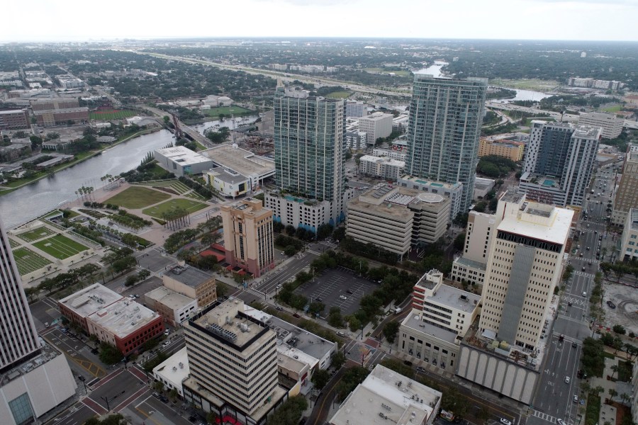
In this aerial image, the city of Tampa, Fla., is seen Monday, Sept. 26, 2022. Hurricane Ian was growing stronger as it barreled toward Cuba on a track to hit Florida’s west coast as a major hurricane as early as Wednesday. It’s been more than a century since a major storm like Ian has struck the Tampa Bay area, which blossomed from a few hundred thousand people in 1921 to more than 3 million today. (DroneBase via AP) 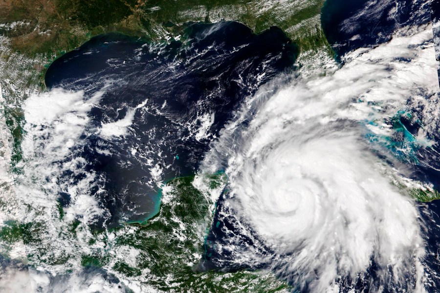
This Sept. 26, 2022, satellite image released by NASA shows Hurricane Ian growing stronger as it barreled toward Cuba. Ian was forecast to hit the western tip of Cuba as a major hurricane and then become an even stronger Category 4 with top winds of 140 mph (225 km/h) over warm Gulf of Mexico waters before striking Florida. (NASA Worldview/Earth Observing System Data and Information System (EOSDIS) via AP) 
Hurricane Ian is forecasted to intensify rapidly and become an even stronger Category 4 hurricane over warm Gulf of Mexico waters. 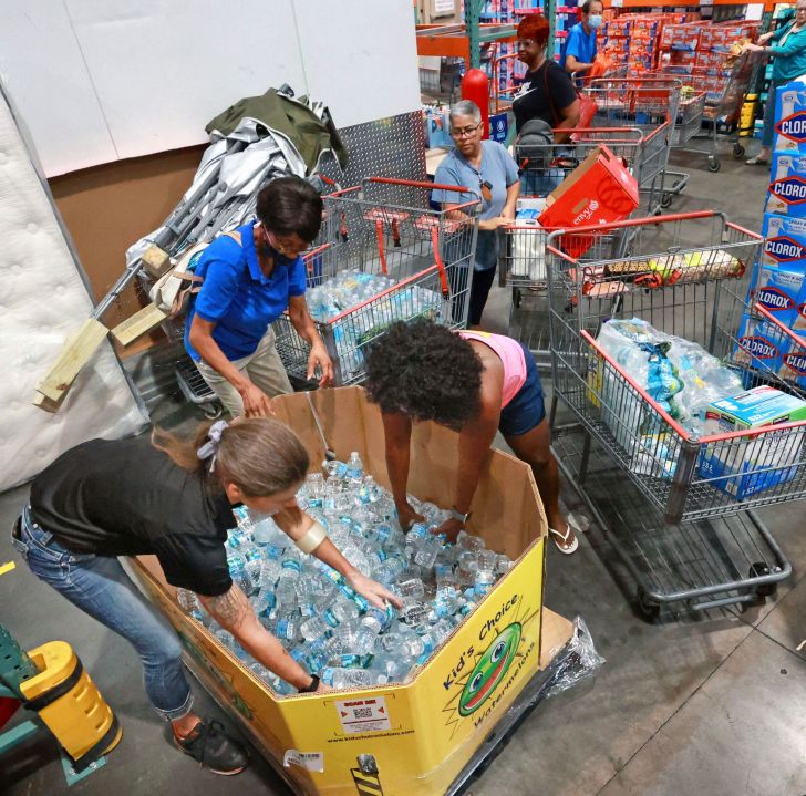
Shoppers at the Costco store in Altamonte Springs, Fla. grab bottles of water from the last pallet in stock on Monday, Sept. 26, 2022, as Central Floridians prepare for the impact of Hurricane Ian. (Joe Burbank/Orlando Sentinel via AP) 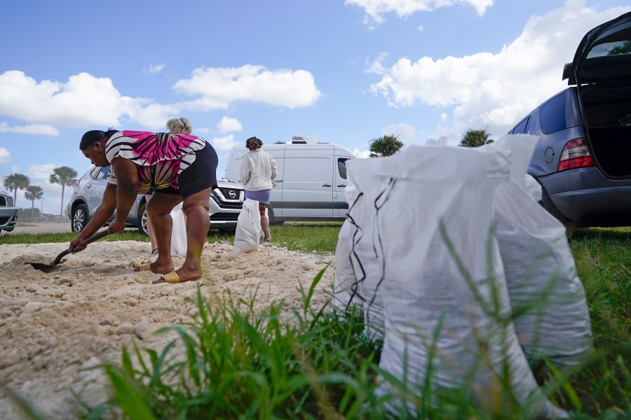
Residents of Orange County fill sand bags at Baldwin Park to protect their homes in preparation of Hurricane Ian, Monday, Sept. 26, 2022, in Orlando, Fla. Ian was growing stronger as it approached the western tip of Cuba on a track to hit the west coast of Florida as a major hurricane as early as Wednesday. (AP Photo/John Raoux) 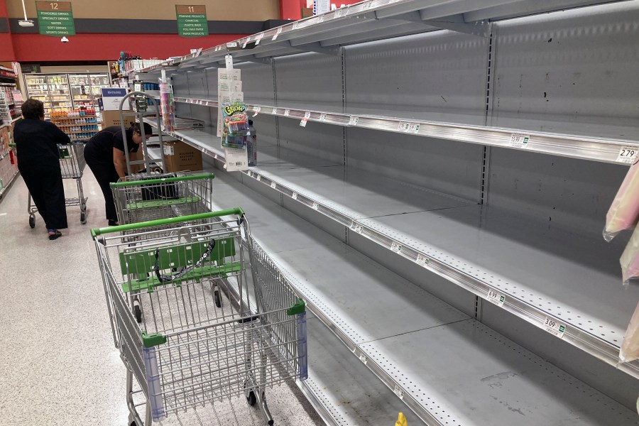
As Hurricane Ian approaches Florida, shopping carts are left abandoned next to empty shelves that stock bottled water at a supermarket Monday, Sept. 26, 2022, in Orlando, Fla. Ian was growing stronger as it approached the western tip of Cuba on a track to hit the west coast of Florida as a major hurricane as early as Wednesday. (AP Photo/John Raoux) 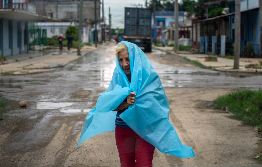
A resident uses plastic as protection from the rain in Batabano, Cuba, Monday, Sept. 26, 2022. Hurricane Ian was growing stronger as it approached the western tip of Cuba on a track to hit the west coast of Florida as a major hurricane as early as Wednesday. (AP Photo/Ramon Espinosa) 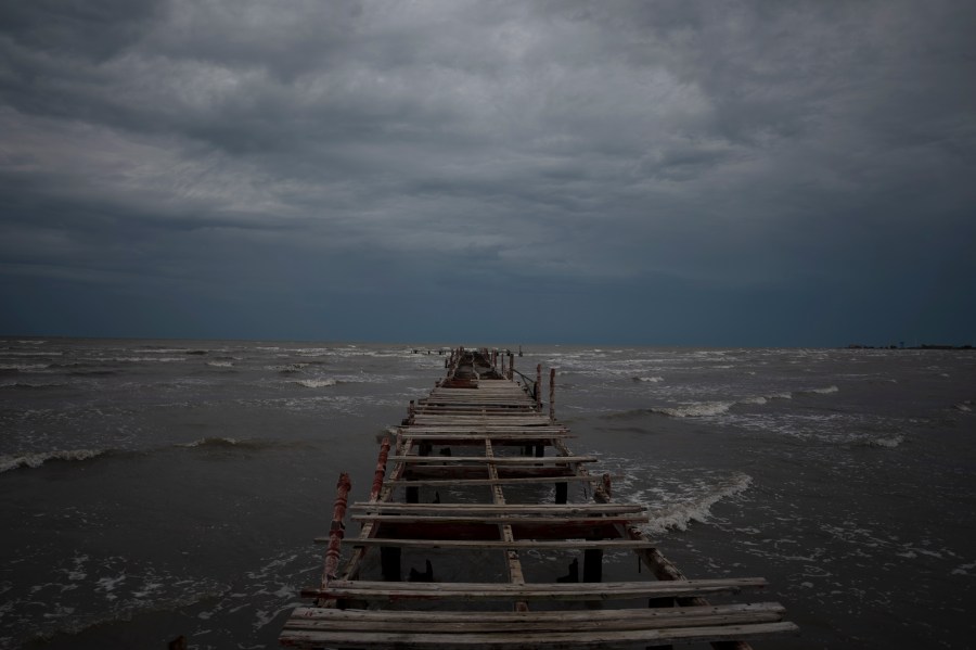
Waves kick up under a dark sky along the shore of Batabano, Cuba, Monday, Sept. 26, 2022. Hurricane Ian was growing stronger as it approached the western tip of Cuba on a track to hit the west coast of Florida as a major hurricane as early as Wednesday. (AP Photo/Ramon Espinosa) 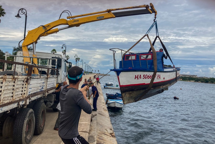
Workers remove a boat from the water in the bay of Havana, Cuba, Monday, Sept. 26, 2022. Hurricane Ian was growing stronger as it approached the western tip of Cuba on a track to hit the west coast of Florida as a major hurricane as early as Wednesday. (AP Photo/Milexsy Duran) 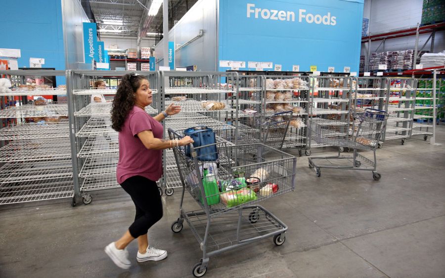
Shoppers find mostly empty bread shelves at a retail warehouse in Kissimmee, Florida, on September 26, 2022. – Tropical storm Ian has strengthened into a Category 1 hurricane the National Hurricane Center said in an advisory, warning that “additional rapid strengthening is expected today.” (Photo by Gregg Newton / Gregg Newton / AFP) (Photo by GREGG NEWTON/Gregg Newton/AFP via Getty Images) 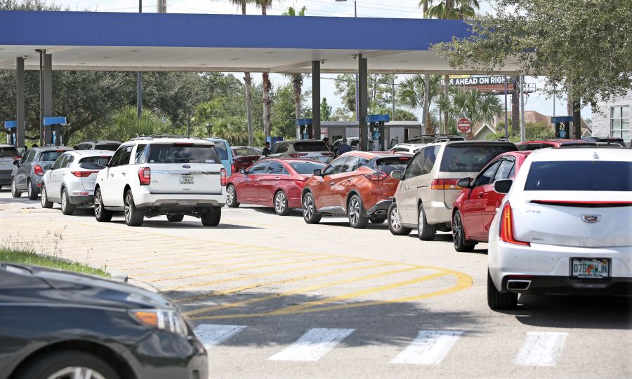
Motorists wait in long lines to fill their vehicles with gas ahead of the oncoming storm in Kissimmee, Florida, on September 26, 2022. – Tropical storm Ian has strengthened into a Category 1 hurricane the National Hurricane Center said in an advisory, warning that “additional rapid strengthening is expected today.” (Photo by Gregg Newton / Gregg Newton / AFP) (Photo by GREGG NEWTON/Gregg Newton/AFP via Getty Images) 
ST. PETERSBURG, FLORIDA – SEPTEMBER 26: Chris Tate (L) and Heather Tallmadge fill sandbags at Helen Howarth Park as they prepare for the possible arrival of Hurricane Ian on September 26, 2022 in St Petersburg, Florida. Ian is projected to make it’s closest pass to the Tampa Bay area on Wednesday with the current track putting the center 25 miles west of the coastline as it parallels the coast. (Photo by Joe Raedle/Getty Images)


