Hurricane Laura continues storm surge threat along Gulf Coast
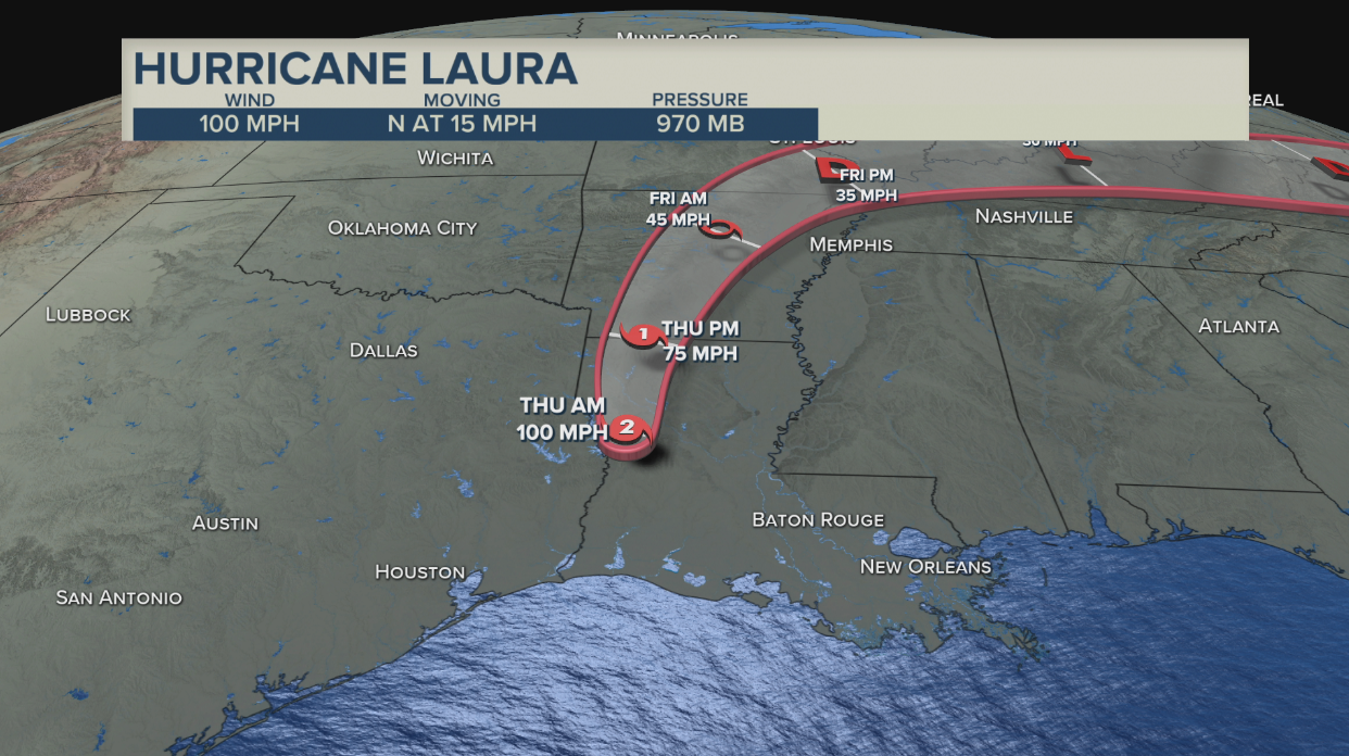
CAMERON, La. (NewsNation) — Hurricane Laura made landfall near Cameron, Louisiana at 1 a.m. (CDT) as an extremely dangerous Category 4 storm, the National Hurricane Center said. The storm has been downgraded to a Category 2 storm, but forecasters say Laura is causing “life-threatening storm surge across much of the Louisiana coastline.”
Maximum sustained winds were near 150 miles per hour at 1 a.m., with higher gusts, making it the most powerful hurricane to strike the U.S. so far this year.
A storm with winds of 157 miles per hour meets the criteria for a Category 5 hurricane.

The storm showed some signs of weakening by dropping to 100 miles per hour sustained winds at 7 a.m., according to the NHC.
The storm is moving north at 15 miles per hour.
“The eyewall of Laura will continue to move inland across southwestern Louisiana during the next several hours,” the NHC said in its 2 a.m. update. “TAKE COVER NOW! Treat these imminent extreme winds as if a tornado was approaching and move immediately to the safe room in your shelter. Take action now to protect your life!”
Some 620,000 people were under mandatory evacuation orders in Louisiana and Texas.
The storm grew nearly 87% in power in just 24 hours to a size the National Hurricane Center called “extremely dangerous.” Drawing energy from the warm Gulf of Mexico, the system arrived early Thursday during high tide as the most powerful hurricane to strike the U.S. so far this year.
The catastrophic storm surge could penetrate up to 40 miles inland from the coastline between Sea Rim State Park, Texas, and Intracoastal City, Louisiana and could raise water levels as high as 20 feet in parts of Cameron Parish, Louisiana, the NHC said. Floodwaters will not fully recede for several days after the storm, the NHC said.
“To think that there would be a wall of water over two stories high coming on shore is very difficult for most to conceive, but that is what is going to happen,” said National Weather Service meteorologist Benjamin Schott at a news conference.
Most of Louisiana’s Cameron Parish would be underwater at some point, Schott added.
“The word ‘unsurvivable’ is not one that we like to use, and it’s one that I’ve never used before,” Schott said of the storm surge.
Watches and warnings:
- A storm surge warning is in effect for:
- Freeport Texas to the Mouth of the Mississippi River
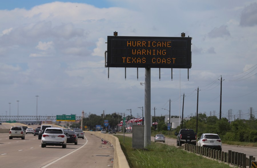
- A hurricane warning is in effect for:
- High Island Texas to Intracoastal City Louisiana
- A tropical storm warning is in effect for:
- San Luis Pass to High Island Texas
- East of Intracoastal City Louisiana to the Mouth of the Mississippi River
- A hurricane watch is in effect for:
- East of Intracoastal City to west of Morgan City Louisiana
Marc Gustafson, a reporter with NewsNation affiliate KARK-TV posted video on Twitter shortly after 12:30 a.m. of the powerful storm in Lake Charles, Louisiana.
The risk for a few tornadoes continues into Thursday across Louisiana, Arkansas, and western Mississippi.
Temporary housing was being hastily erected outside the storm surge zone for evacuated residents, and emergency teams were being strategically positioned, state and federal emergency management agencies said.
Federal Emergency Management Agency (FEMA) Administrator Pete Gaynor posted pictures of portable shelters on Tuesday at Camp Beauregard, Louisiana, about 115 miles north of the Gulf Coast.
Texas Gov. Greg Abbott said his state’s National Guard was in place with high-water vehicles and rescue helicopters.
While Houston had earlier in the week feared Laura would deliver a direct hit to the fourth-largest U.S. city, the storm has shifted east and Houston, which was devastated by Hurricane Harvey in 2017, looked likely to escape the worst of it.
Louisiana Gov. John Edwards said that the state’s entire National Guard had been activated for the first time since 2012.
MANDATORY EVACUATIONS

More than 420,000 Texas residents and another 200,000 people in neighboring Louisiana were under mandatory evacuation orders.
Sarah and Brad Cooksey were filling up their RV at a gas station in Katy, Texas along their evacuation route from low-lying Port Arthur to a campground in Columbus.
“We’ll see what we come back to,” Brad Cooksey said. “Nothing we can do about it.”
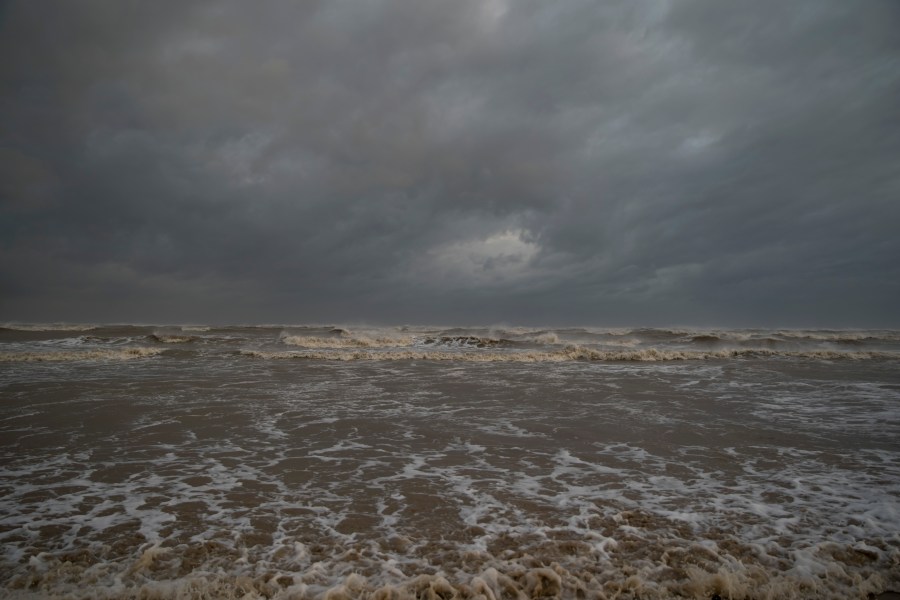
Skies were dark, a light rain was falling and the surf was strong on Wednesday morning in the island City of Galveston, which was mostly boarded up.
Randall Gilmore, a 48-year-old maintenance worker, was riding his bike along the city’s sea wall before he planned to evacuate to nearby Texas City in the afternoon.
“This storm doesn’t look like it’ll be bad so far, but I feel it’s better to leave. You never know what to expect with these storms,” Gilmore said.
Officials said at least 150 people refused pleas to leave and planned to weather the storm in everything from elevated homes to recreational vehicles in coastal Cameron Parish, which could be completely covered by ocean water.
“It’s a very sad situation,” said Ashley Buller, assistant director of emergency preparedness. “We did everything we could to encourage them to leave.”
The storm was also expected to spawn tornadoes Wednesday night over Louisiana, far southeastern Texas and southwestern Mississippi and drop 5 to 10 inches of rain over the region, the NHC said. It added there would likely be widespread flooding from far eastern Texas across Louisiana and Arkansas from Wednesday to Thursday.
Crude oil production in the Gulf of Mexico has been paralyzed as companies batten down operations. Output cuts are nearing 90%, a level not seen since Hurricane Katrina in 2005.
LANDFALL DURING PANDEMIC
Hidalgo County urged voluntary evacuation in the coastal region surrounding Houston, and shelters were set up in San Antonio, Dallas and Austin. Thousands of evacuees would be sheltered at hotels in Austin, instead of schools, to encourage social distancing during the coronavirus pandemic, the Austin American-Statesman reported.
Jared Brown, 39, was heading to a friend’s house in Austin from his home in Lake Charles, Louisiana on Wednesday. He had decided that would be safer from viral exposure than a hotel, where he normally would have taken shelter.
“Luckily he didn’t mind,” Brown said of his friend.
Lina Hidalgo, the top executive for Harris County, which encompasses Houston, signed a disaster declaration for the county on Wednesday.

CONTEXT ON THE STORM
The hurricane also threatened a center of the U.S. energy industry as the majority of Gulf oil and natural gas production shut down. Consumers are unlikely to see big price hikes, however, because the pandemic has decimated demand for fuel.
Laura closed in on the U.S. after killing nearly two dozen people on the island of Hispaniola, including 20 in Haiti and three in the Dominican Republic, where it knocked out power and caused intense flooding.
Laura will be the seventh named storm to strike the U.S. this year, setting a new record for U.S. landfalls by the end of August. The old record was six in 1886 and 1916, according to Colorado State University hurricane researcher Phil Klotzbach.
Reuters reporting by Ernest Scheyder in Galveston, Texas; Writing by Gabriella Borter; editing by Jonathan Oatis and Marguerita Choy and Cynthia Osterman.
Associated Press contributors include Melinda Deslatte, Jeff Martin, Stacey Plaisance, John L. Mone in Port Arthur, Texas; Gerald Herbert in Lake Arthur, Louisiana; Paul J. Weber in Austin, Texas; Seth Borenstein in Kensington, Maryland; Juan A. Lozano in Houston; Jake Bleiberg in Dallas; Jay Reeves in Birmingham, Alabama; Jill Bleed in Little Rock, Arkansas; Julie Walker in New York and Sophia Tulp in Atlanta.


