(NewsNation Now) — The tropics continue to break records as three storms were named in less than 24 hours, pushing the total number of storms for the season up to 23, the most named storms ever at this point in a hurricane season.
The only other time on record that the Atlantic had 3 named storm formations on the same calendar day was August 15, 1893. And for only the second time ever, the primary hurricane names list was exhausted and the Greek alphabet had to be used. The first time was in 2005, and that record-breaking hurricane season produced infamous storms like Katrina, Wilma, and Rita.
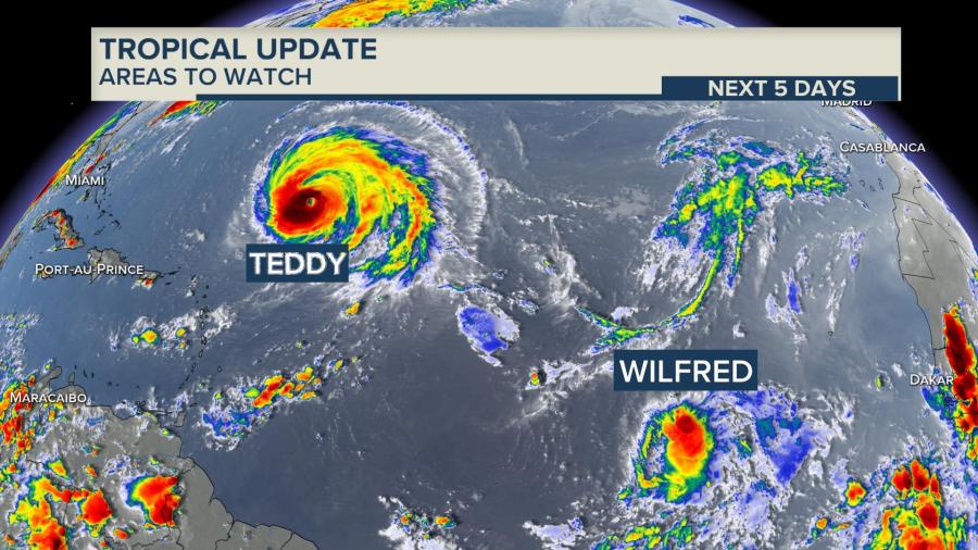
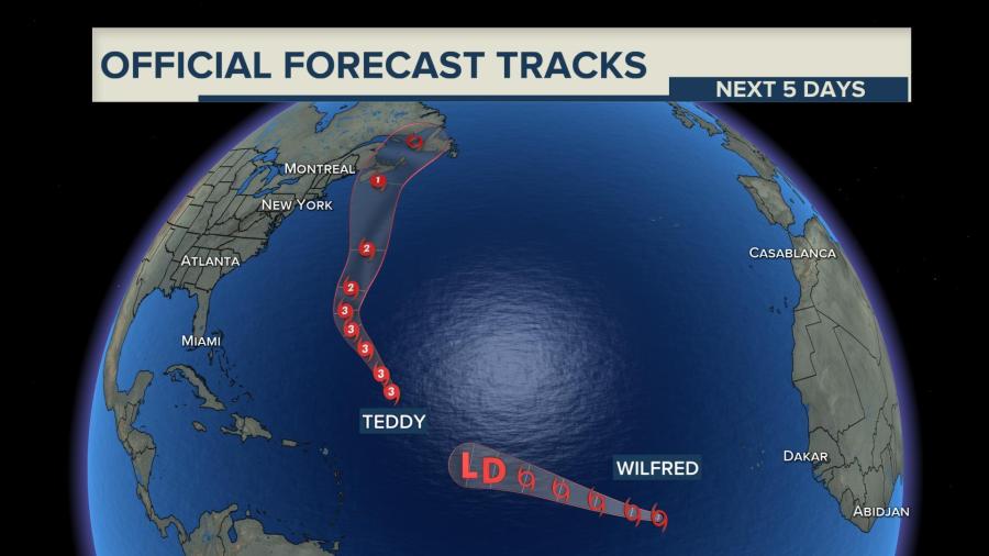
Major hurricane Teddy continues to spin in the central Atlantic while Tropical Storm Wilfred became the 21st named storm earlier Friday. Teddy will continue to track north as a Category 3 storm with 130 mph sustained winds as it heads north in the direction of Nova Scotia.
Huge waves will pound Bermuda along the way and hurricane-force winds and rain may also impact the island. Wilfred will continue to struggle as a tropical storm over the open ocean heading north west.
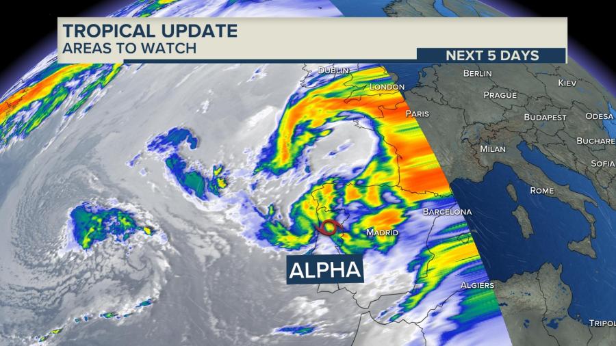
Subtropical storm Alpha was named for the only the second time in history for the use of the Greek alphabet and hit Portugal and Spain on the far eastern extreme of the Atlantic basin where it brought winds over 50 miles per hour and heavy rain. It is expected to weaken over land through Saturday.
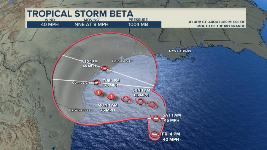
On the other side of the Atlantic basin and after several days of close surveillance, Tropical Storm Beta was the third and most recently named storm of the day. As of Friday 10 p.m. CT, the National Hurricane Center issued hurricane watches for parts of the Texas Coast. Beta is likely to strengthen over very warm Gulf of Mexico waters and low wind shear. This is a highly favorable environment for a hurricane and will likely become one in the coming days.
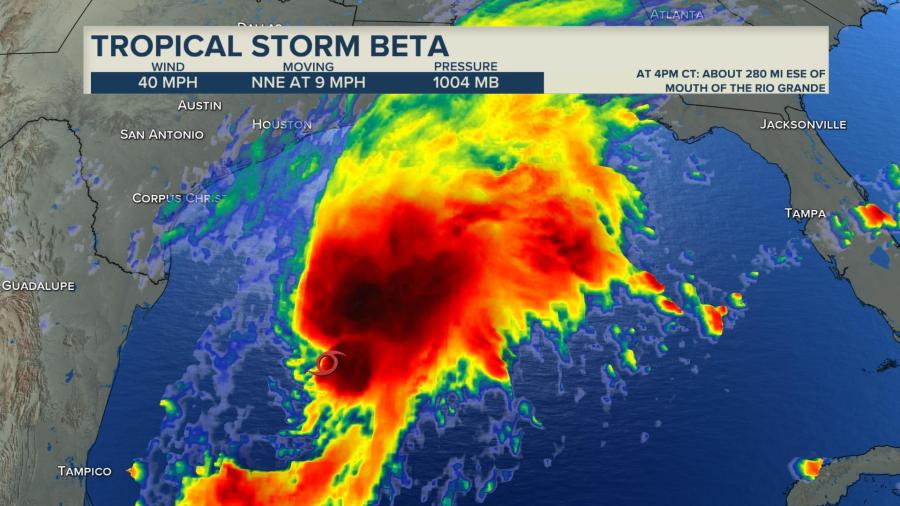
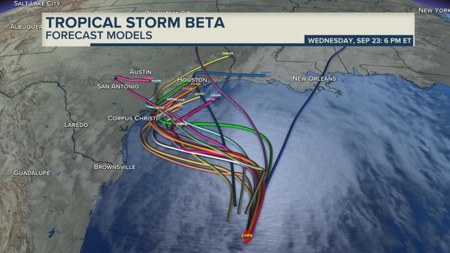
Beta’s official forecast track and cone from the National Hurricane Center brings the storm very near to the Texas coast sometime Tuesday. The forecast models are pretty diverse in the track, hence the wide cone of uncertainty. The general trend is for Beta to turn to the west before eventually being scooped up by a trough of low pressure to swing it back to the northeast. There is still plenty of unpredictability with Beta right now so it is very important to not focus on the center of the forecast track, especially from Monday onward.
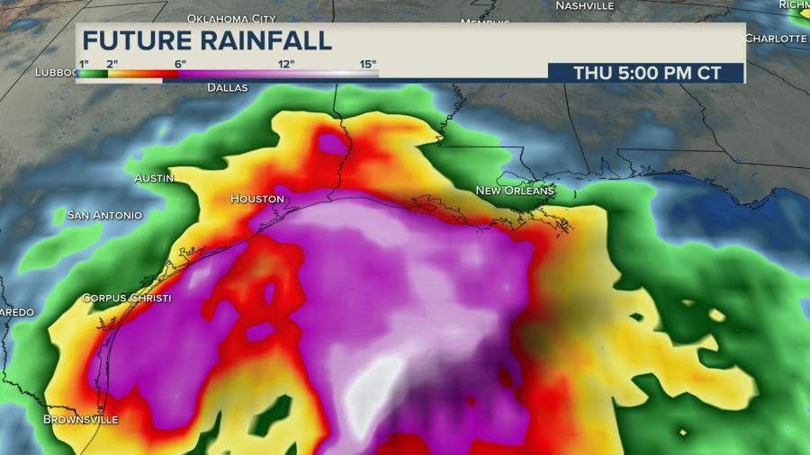
If, and it is a big “if,” Beta’s current forecast transpires and takes a track riding the Texas coastline. Torrential rainfall would be likely and significant flooding could occur. Some early forecast models are showing conservatively 10″-12″ of rain with locally higher totals from Corpus Christi up toward the Houston/Galveston area but it is still very distant in the forecast so changes are to be expected.
The exceptional 2020 hurricane season will continue to be watched closely in the next several days with special attention to tropical storm Beta as it nears the US coast of Texas. Updates on this storm’s track and path will be posted by the News Nation Weather team on NewsNationNow.com as well as our Twitter and Facebook pages.
Follow: Albert Ramon on Facebook & Albert Ramon on Twitter, Meteorologist Gerard Jebaily on Facebook & Gerard Jebaily on Twitter


